


| Home | Daily Reports | April | Day 24 |
|
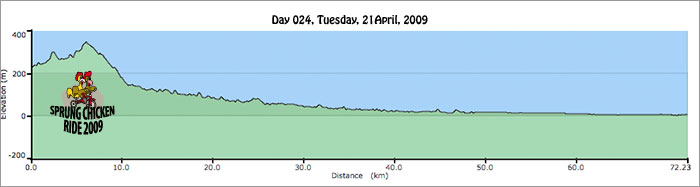
Day 024, Tuesday, 21 April, 2009 Distance travelled – 72.9 km Wadeville, Kyogle Road, Murwillumbah, Tweed Valley Way, Chinderah
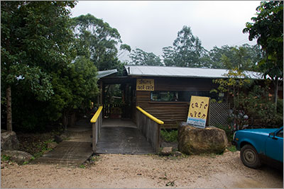
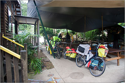
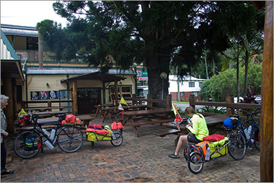
After a very quiet and comfortable night we woke to a cool morning with overcast skies. By the time we left Wadeville for Murwillumbah, (about 10.30) it was raining heavily enough and cold enough for us to require our raincoats. There were a couple of steep hills soon after we left and climbing these warmed us so much that we stopped to take our raincoats off even though it was still raining very heavily. Soon after we did though, the road warning signs indicated we were in for a good downhill run so we stopped and put our coats on again as we knew it would be cool. Traffic was light but the road was quite bumpy with a combination of potholes, patched potholes and patches on top of patches. The road remained rough and slow going to just after Uki. As we made slow progress along the road we began to wonder if all roads lead to Nimbin as we passed many turnoffs to that iconic town. We stopped at Mt Burrell and the Sphinx Rock Cafe for morning tea just as the rain started to really come down. Luckily it had eased a little by the time we left. It rained on and off for the rest of the day. We stopped at Uki for lunch, and even though I had made sandwiches, we decided that it would be more pleasant sitting in the Mt Warning Hotel for a hot lunch rather than outside in the rain with a picnic. There was a small bus of elderly people having lunch at the pub and a number were particularly taken by our trip and most encouraging to make sure we complete it. A couple confided they wished they had done such a trip when they were younger. We took this as an endorsement of our decision to take the year off. The road surface improved after Uki and we had a pleasant run into Murwillumbah. We inquired at the Information Centre on caravan park accommodation in the town and were recommended to go another 20km to Chinderah, which is about 10km south of Tweed Heads. It was about 3.30 by this time so we made the decision to not look around Murwillumbah and do the extra 20km as we were assured the road was good and flat. The Tweed Valley Way was indeed flat, the road surface good, and there was a shoulder for most of the way. We made good time, arriving at Homestead Holiday Park before 5pm after stopping off to buy some supplies at the local shop. Next to no photos taken today even though we were travelling through some unique country. Firstly everything was covered by clouds and secondly the cameras were packed away in their dry sacks. Also our handle bar cam lens kept fogging up so we turned it off rather than have a collection of unusuable video clips. So we do not have much to show you. Today was a hard day, not distance wise, but because the road was so rough it was hard to keep our momentum going. It felt like we would hit a hole in the road with the front wheel push the back wheel through but then be dragged back as the trailer wheel followed through. It was good to do the last 20km from Murwillumbah as it was very smooth and fast riding, but we were very glad to get to bed and slept extremely soundly. Zoom into the map and use the 'Satellite' layer to see our new location.
Sphinx Rock Cafe, Mt Burrell
Sphinx Rock Cafe, Mt Burrell
Mt Warning Hotel, Uki
|
Home | Daily Reports | About | Contact Us | Merchandise | Site Map
© 2008 Mark Arundel