


| Home | Daily Reports | May | Day 046 |
|
Day 046, Thursday, 14 May 2009
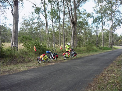
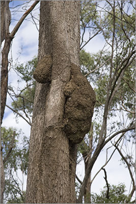
Distance travelled – 65.9 km Bundaberg, Rosedale Last Monday when we were still in Childers, local ABC Radio Wide Bay was running a competition that required you to write a paragraph using the word ‘diurnal’. So we sent in a paragraph about our diurnal ride around Australia. On Tuesday Wayne Shearman, the presenter of the breakfast show, recorded a short interview about our trip with both Denise and I and this morning it went to air at 6.45am. Listen to Wayne’s story. Originally today’s leg was to be from Bundaberg to Miriam Vale a distance of 127km, a distance we were not keen to attempt as we suspected the road would be up and down with not the most optimum surface. We discovered through ‘Camps 4’ that the Rosedale Hotel had a small caravan park so after a quick telephone call we decided to break the trip into two with a stop at Rosedale. We started the day by retracing our path to the Hinkler Hall of Aviation as yesterday we discovered that Denise’s helmet cam did not record the original trip. As the Hall was on our way out of town this was not a great chore, we just needed to make sure we did not show a fully loaded bike in the vision so we can use it with the video that we recorded yesterday. If we produce a video of the trip look out for the piece on Bundaberg as the sky may look different between clips used to tell the Hinkler story. The first 20 km today was level riding through cane fields crisscrossed by a cane railway. As the cane fields finished we found ourselves at the Avondale Tavern. For a pub in what appears to be (at least to a touring cyclist) in the middle of nowhere, we were surprised by the acts it attracts with Wendy Matthews and Diesel appearing over the next month. After Avondale the road is very much up and down. Unfortunately we had troubles with our Edge 705 GPS so we do not have any elevation profiles for today and tomorrow showing you the ups and downs. Today the Edge was asking us to turn left and right on non-existent roads and when we did not do this it then started to request u-turns so we turned the navigation off. We are not sure if this was due to the Edge or the mapping data that it relies on. We are presently trying to get a replacement unit as among other problems the unit’s barometric altimeter records changes in altitude whilst we are stationary. We also get changes in altitude when it begins to rain. I suspect we will write more on this later. We stopped for lunch on a side road (that did exist), and discovered a white ant ‘sculpture’ that we thought looked like a koala or small dog peeping over a branch. See the photos. When we pulled into Rosedale we came across a fellow riding out of town on a loaded bike. As it turned out he had been on the road for two days starting in Rainbow Beach. He was travelling extremely light and by Denise and my standards doing things the hard way. His bike was 12 speed but he told us he only used 6 gears. He had no back brake and no handle bar tape on the drop bars. On his back he had a small rucksack and on the back rack a sleeping bag and sleeping mat. He did not have a tent or any cooking equipment. However he was totally enjoying himself and indicated he was going to camp along the road tonight. After a brief chat he decided to join us at the caravan park for the company. Zoom into the map and use the 'Satellite' layer to see our new location.
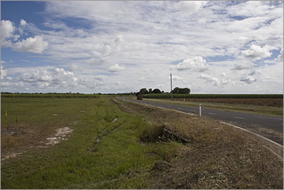
Corner of Bucca Road and Bundaberg to Rosedale Road
Rest stop between Avondale and Rosedale. Many of the trees had white ant nests growing out of their trunks.
This particular white ant nest looked like a koala or small dog looking over a branch.
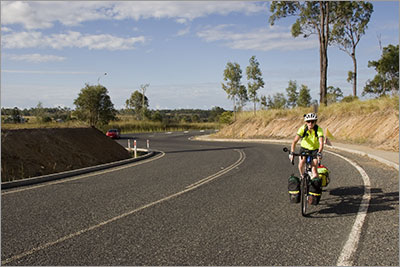
Denise turns into Rosedale |
Home | Daily Reports | About | Contact Us | Merchandise | Site Map
© 2008 Mark Arundel